|
|
|

Has all the
features of Natural Scene Designer 5.0
plus georeferencing, reprojection and more
Available for Mac and Windows.
Natural Scene Designer Pro 5.0 builds on the versatility of the standard version 5.0 by adding several additional capabilities.
* Interactively georeference images and terrain models
* Reproject from / to any supported projection
* Includes 34 of the most common map projections
* Full projection parameter control
* Can reproject TIF images up to 26,000 x 26,000
* Supports all US State Planes
* Choose among 230 map datums
* Five georeferencing methods
* Decollars map borders
* Imports, overlays, and renders shape files
* Lets you import a bump map
* Renders planimetric oblique relief images
* Copies GeoTIFF tags from one image to another
* Includes both 32 and 64 bit versions!
Order
your copy of Natural Scene Designer Pro 5.0 today! Upgrades are
also available for customers with prior versions.
Supported
Projections
Albers
Azimuthal Equidistant
Bonne
British Grid
California Teale Albers
Eckert IV
Equidistant Conic - 1 parallel
Equidistant Conic - 2 parallels
Geographic
Gnomonic
Goode Homolosine
Hammer-Aitoff
Lambert Azimuthal
Lambert Conformal Conic
Mercator
Miller
Mollweide
Oblique Mercator
Orthographic
Perspective
Polyconic
Robinson
Sinusoidal
State Plane 1927
State Plane 1983
Stereographic
Tilted Perspective
Transverse Mercator
Two Point Equidistant
US Albers
UTM
Winkel I
Winkel II
Winkel Tripel
|
|
|
|
|
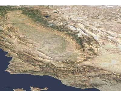
California's Central Valley. Satellite photo draped over terrain
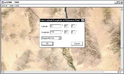
Easily georeference by clicking on known points
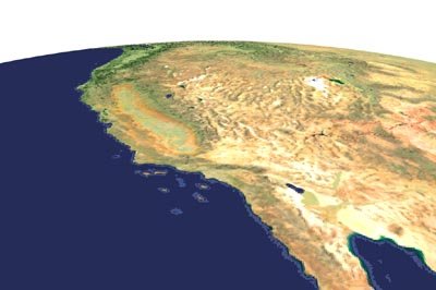
Western USA shown in the Tilted Perspective projection
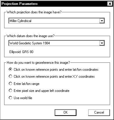
Select among 34 projections, 230 datums, and 5 georeference methods!
|
|